 For full access to all OER Project resources AND our amazing teacher community,
By the OER Project Team
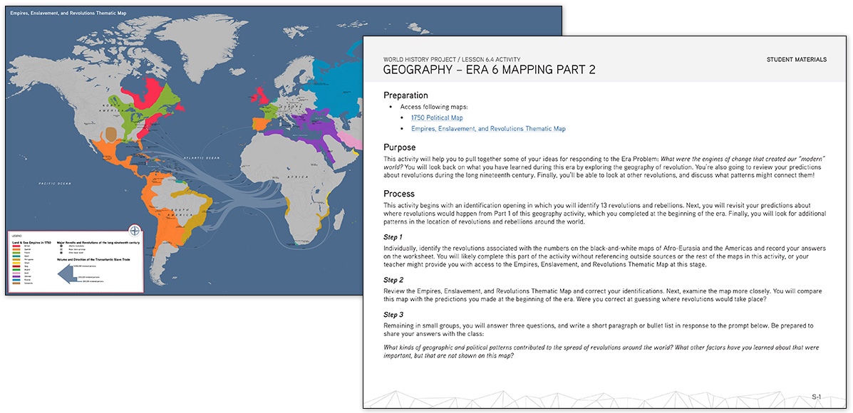
We know that understanding geography and maps is something students often struggle with (let’s face it: many adults do too!). That’s why each flavor of the World History Project (WHP) course, a standards-aligned world history curriculum designed for high-school students, includes a series of maps to help students orient themselves in time and space. These highly detailed world maps cover periods from 300 BCE to the Cold War.
Each map includes three layers. First, a political map identifies the many communities that students will encounter in each unit. These communities include the usual suspects, such as large empires and nation-states. But we’ve also made a concerted effort to represent the variety of non-state communities that exerted sovereignty and influence alongside states, particularly in Oceania, sub-Saharan Africa, and the Americas. These political maps will make it easy for students to quickly identify changes and continuities over time (CCOTs).
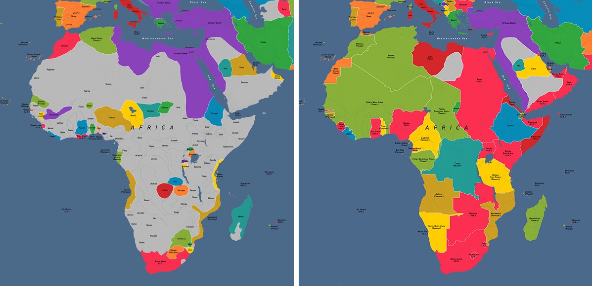
For one particularly dramatic illustration of CCOT, students might examine the colonization of Africa between 1871 (left) and 1914 (right)
Each map also includes a thematic layer that provides students with evidence to support, extend, and challenge the frame narratives and respond to the big questions we ask in each unit. These detailed thematic maps dig into topics such as the transatlantic slave trade, the spread of religions, trade routes, and the world wars. Finally, each map includes a blank black-and-white version of the political map, which teachers can zoom in on and crop to their needs for use in quizzes and activities.
These maps are fully integrated into all three WHP courses, as are accompanying mapping activities, which we like to call “maptivities.”
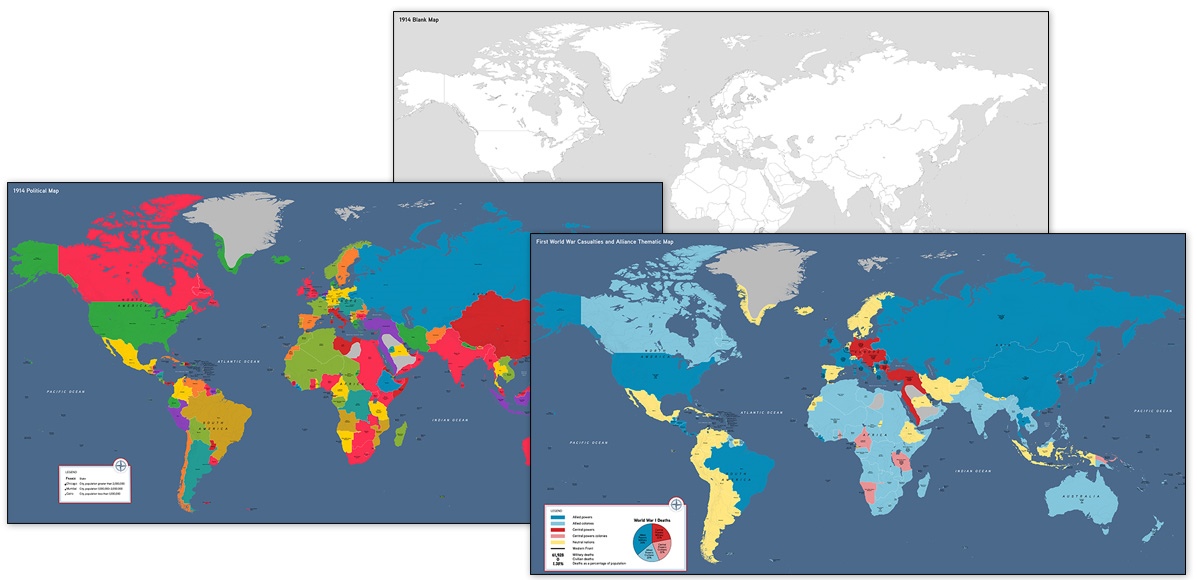
World maps, from top to bottom: blank map for printing, political map, thematic map.
Maptivities
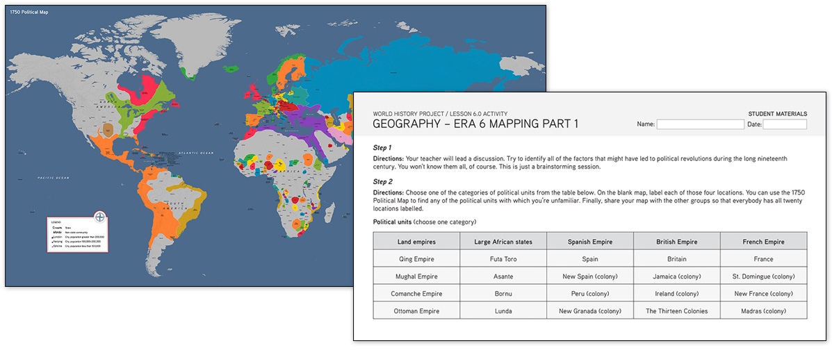
Each WHP era or unit includes two activities related to maps. An opening geography activity orients students in time and space, providing some geographic context for what the world looked like in that time period. In these opening activities, students are asked to examine a set of maps and brainstorm some predictions about major changes in the coming era/unit.
Toward the end of each unit, the more detailed closing map activities have students applying their CCOT and causation skills to analyze themes such as long-distance trade, the spread of religion, the transatlantic slave trade, and imperialism. In these closing activities, students use geographic evidence to respond to writing prompts based on the unit/era problems and frame narratives.
Using the maps
Maps can be used online or downloaded as image files for use offline. When used online, WHP’s maps make use of the deep zoom tool so teachers and students can zoom in to different scales and see a high level of detail across different sections of the map.
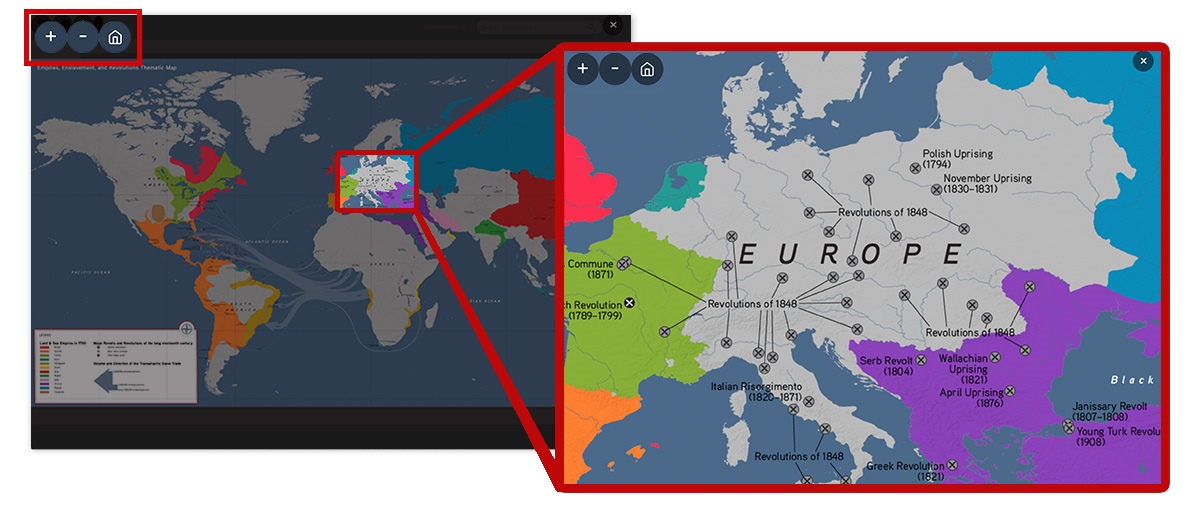
Teachers and students can use the embedded navigation tools to zoom in, zoom out, and reset each map.
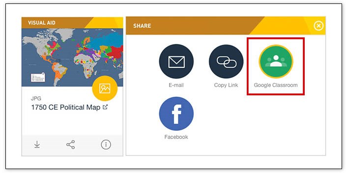
Like most OER Project materials, these maps can be downloaded or printed for offline use. Teachers can also easily export these maps to their Google Classrooms.
Finding the maps
There are a few different ways to find these maps on the OER Project website. First, the chart below details the periodization of the world maps and each one’s thematic focus, along with where they fall in each flavor of WHP.
|
World map |
Origins Era # | 1750 Unit # | 1200 Unit # | Thematic topics |
|
300 BCE |
2, 3 | Ancient Empires and Agriculture | ||
| 100 CE | 3, 4 | Spread of Buddhism and Christianity | ||
| 800 CE | 4 | Spread of Islam | ||
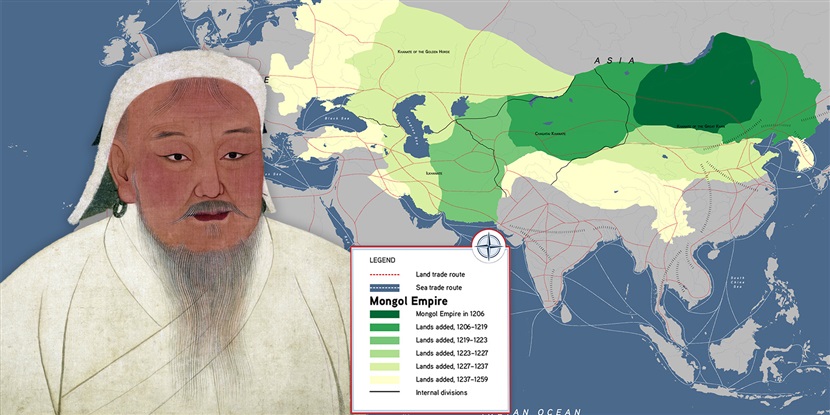
| 1200 CE | 4, 5 | 2 | Mongol Empire and the Black Death | |
| 1450 CE | 4, 5 | 3 | Medieval Trade Routes | |
| 1550 CE | 5 | 3 | Silver Trade and Transoceanic voyages | |
| 1750 CE | 6 | 1, 2 | 4, 5 | Empires, Enslavement, and Revolutions |
| 1871 CE | 6 | 3, 4, 5 | 5, 6 | Industrialization and Imperialism |
| 1914 CE | 6 | 5, 6 | 4, 5, 6, 7 | First World War Casualties and Alliance |
| 1945 CE | 7 | 7, 8 | 7, 8 | Second World War (November 1942) |
| 1975 CE | 7 | 8, 9 | 8, 9 | Decolonization and the Cold War Thematic Map |
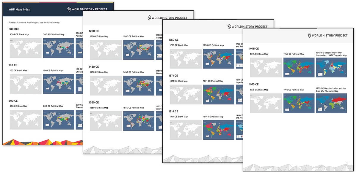
The WHP Maps Index is a downloadable document that has each map linked to make finding these resources as easy as possible.
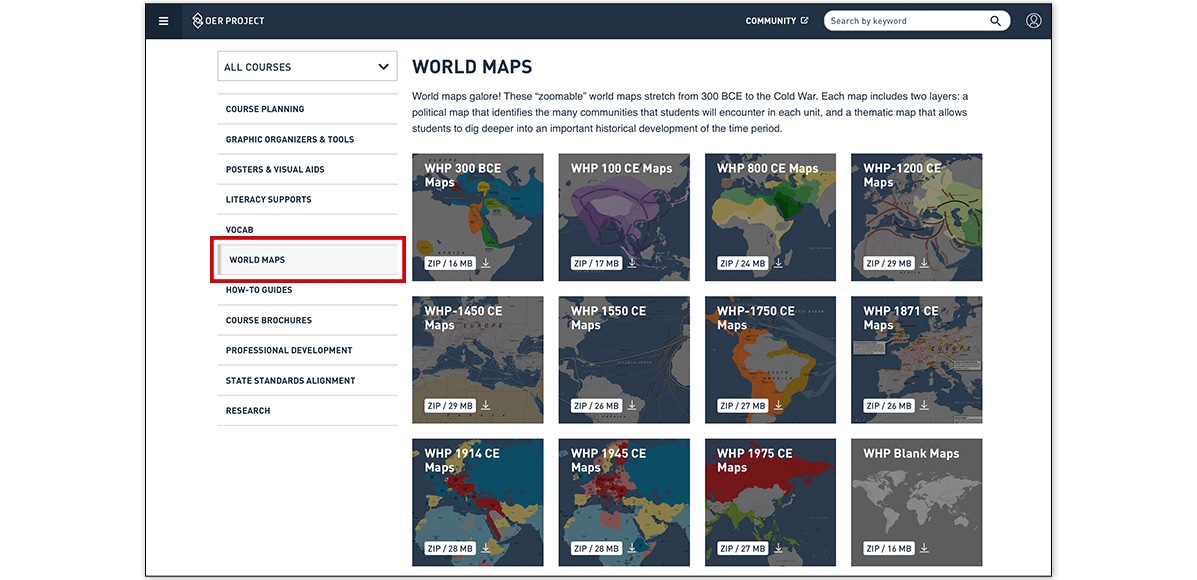
Finally, the teacher resources page also has every map in each flavor of WHP. Using the lefthand navigation menu, teachers can select World Maps to see each collection of maps available and download .zip files of the collections directly to their computers.
As you might be aware, we regularly update content and add new content to all our courses each year (one of the benefits of being an open and online resource!), and this holds true for WHP’s maps too. Make sure to keep an eye on our website for new maps you can use with your students in the future. Happy mapping!
New to OER Project? Explore these maps by registering for a free account today!
